Greetings friends!
I've happened my way back into the CC mindset and have been toying the the idea for a new Pocket mod/ eventually like to create a GC for the battle of Peleliu.
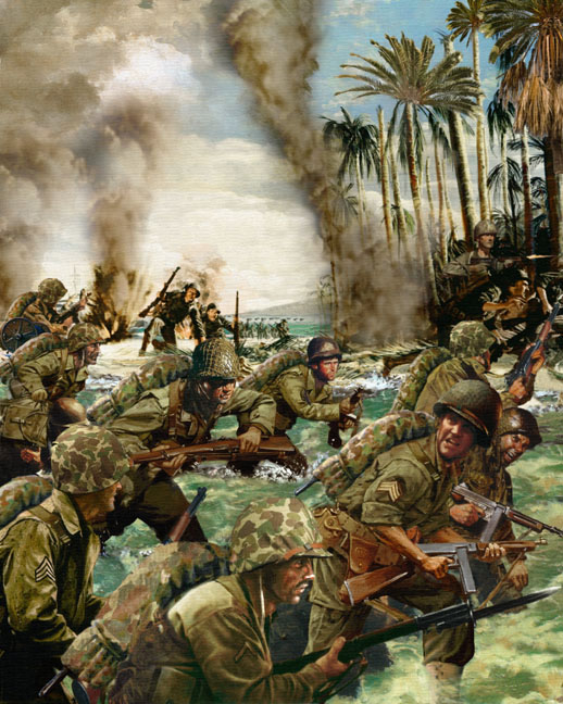
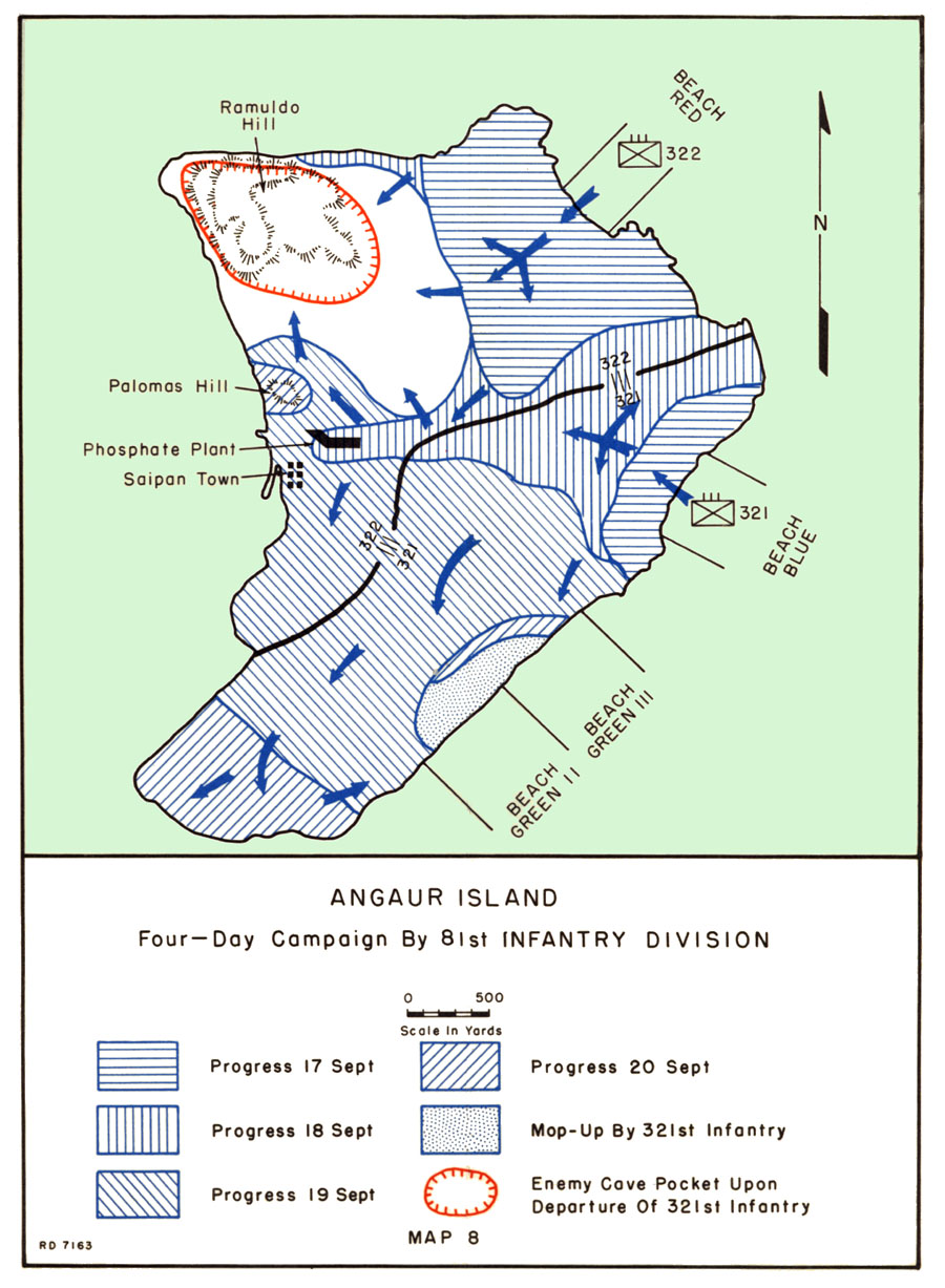
I'm sure many are familiar with this battle largely thanks to The Pacific HBO series. I am considering starting with a pocket mod covering some of the action around portions of the epic clash like the fighting south of Peleliu on Angaur Island or north of Peleliu, Ngesebus Is, and wanted to see if there was an interest in the idea.
Porting this over the Okinawa mod I think would be relatively simpler. Needing only to create and code the maps for the specific areas initially as well as changing/updating some of the involved battle groups and interfaces/artwork.
I've been studying over the details, maps, and images of the battle for a couple of years now and feel confident to begin.
I originally sought help from Yukongold and a few others who were gracious enough to bestow upon me some basic knowledge and materials (textures, tools, etc) but was unable to pursue this at great length.
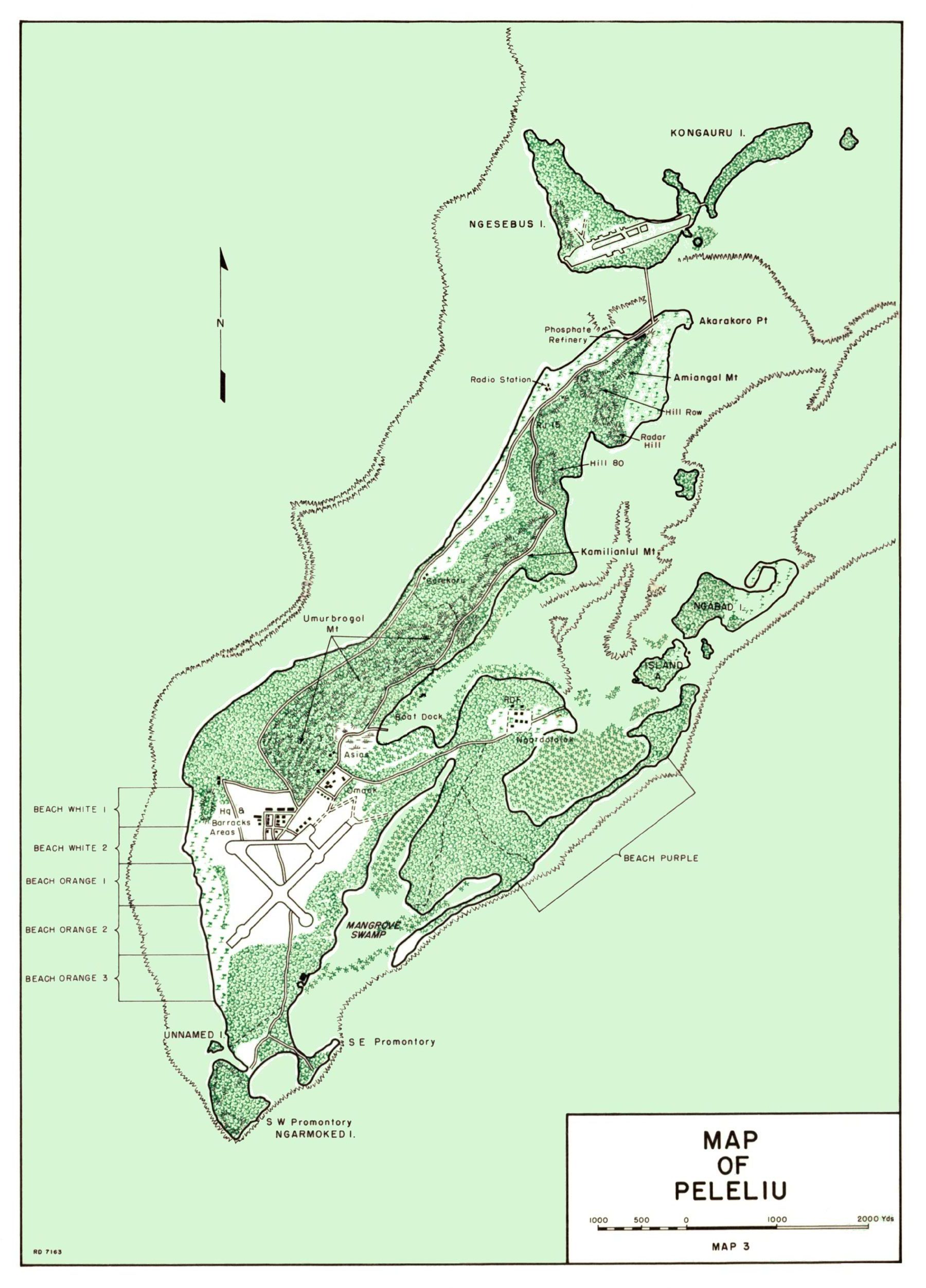
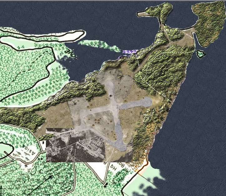
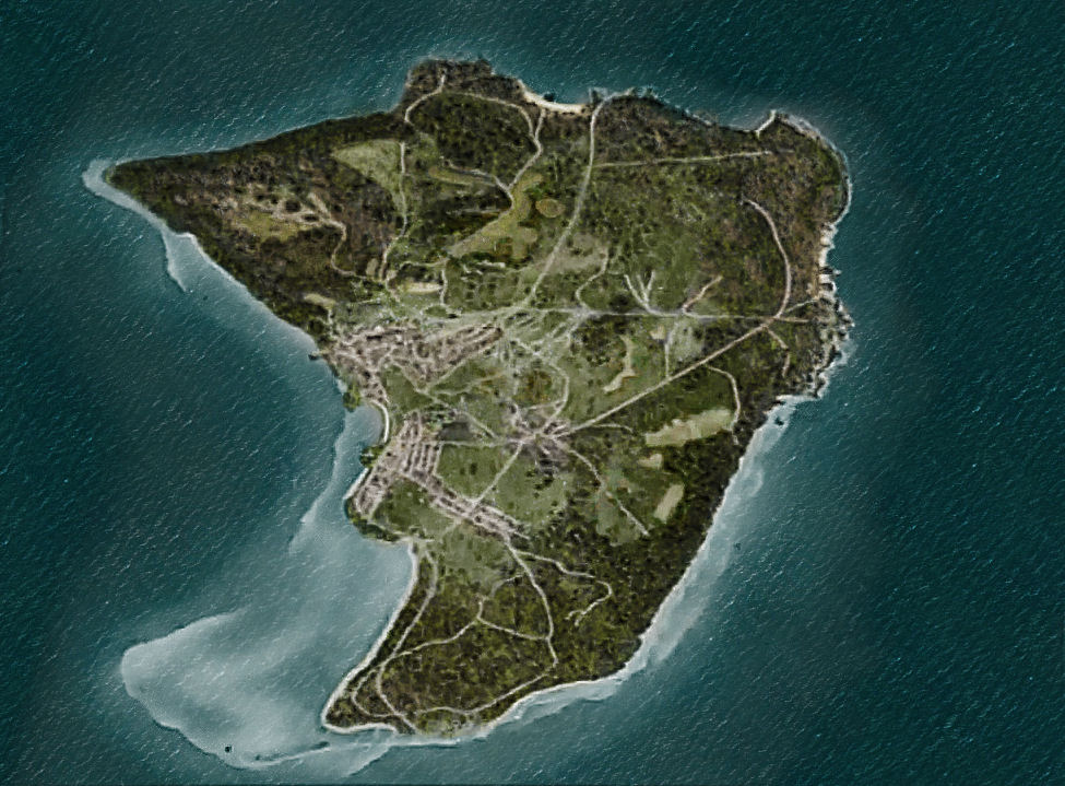
The third/fourth image below is some experimentation with the stratmap idea for the main island. I recall reading something about beach maps requiring to a right to left attack(beach on right?) in order for single battles to work properly. So this is the reason for the orientation of the strat map with N pointing relatively South SW. (anyone know if this is accurate for beach maps to work?)
Again mostly experimenting with different approaches to see what I might do. I layered portions of aerial photographs of the airfield partially in overlay and partially the actual image as reference to the relative accuracy of the strat map testing to the island/maps themselves.
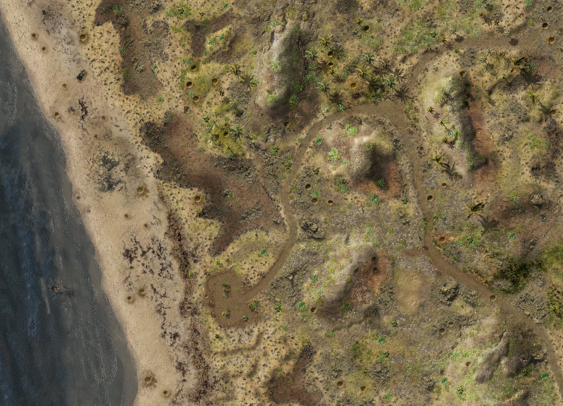
Following is a sample of my first map attempt two years ago, mostly just playing with textures, (clearly shown the cc5 beach map reversed) cc3 pacific trees, testing my own trees etc just trying to experiment with different looks.
A recent discovery of a huge cache of photos from the battle has given me new perspective on the area and the ability to create fairly accurate maps to reflect the action, whereas my first attempt was merely an imagining with little factual respect to the area around the beaches.
Some issues with the eventually GC i believe would be:
1. The length of the battle ran roughly over two months, so I'm not sure how to reflect this in relativity to the CC5 engine(assuming it is the one used)
2. Gains made by the invading marines made by the 2nd day included all of the airfield and most of the southern island. Yet the fighting in and around Umurbrogal Mountain, "Bloody Nose Ridge" lasted for weeks.
The relative distances for the airfield in actuality scaled down and compared on a 1:1 ratio for "game play" would make creating a map size capable of reflecting potential gains of territory on a map equivalent to historical ones difficult/impossible. Or so I perceive. not sure how this could be overcome, other than sacrificing some historical consistency for playability purposes.
My goal I believe (wisest path to proceed with) would to be to create a pocket again, focusing on Ngesebus or Angaur Islands.
There are many questions I would have, for example If It is necessary to orient the StratMap so the invasion beaches are on the right.
Could the campaign feature beach maps that are coded in such a way to function as a supply without needing the "beach map orientation", and show only the beach map terrain for aesthetic purposes?
A summary of the battle can be found at wikipedia, and a more indepth/detailed accounting can be found Here:
http://www.ibiblio.org/hyperwar/USMC/USMC-M-Peleliu/
So i'd like to get others feedback on the possibly of this , your thoughts, opinions, suggestions, etc, or if you don't believe this is a good idea, please feel free to give honest feedback.
Cheers,
LD.