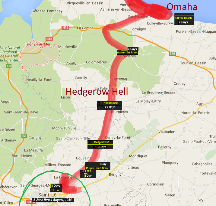
#1: St Lo. Campaign Map Author: vobbnobb, Posted: Sun Feb 07, 2016 2:06 am — I was bored so I listened to the videos, and put together a map of the cc1 campaign using google maps.. Of course the map I used is modern and some places, roads and areas may not exist today. Close Combat is based on the fighting of the U.S. 29th Infantry Division and the German defenders from Omaha Beach to Saint-Lo. A lot of towns were mentioned in them.
St Lo was an important Normandy road junction that connected east to west and north to south and it was coveted by both sides for this importance. Bradley wanted it and the Vire River to its west for another reason as well. If the US 1st Army was going to be successful in Operation Cobra, Bradley had to control the city and the river. The Germans knew the importance and would do everything in their power to prevent the Americans from having the sector. The battle would turn out to be hard fought and one of the most costly in the Normandy campaign. The US had over 12,000 casualties in the immediate area of St Lo alone and 40,000 in the entire campaign.
From Omaha to St. Lo, 43 days just to get there. After Saint Lo was taken the breakout could begin..
There is a sad story to the city as it was obliterated and had to be rebuilt. If you use google maps and look at hedgerow! area on my map and go to street view you can see the crazy bocage they had to fight in.