


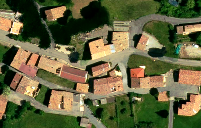
| Before.png | ||
| Description: |
|
|
| Filesize: | 1.29 MB | |
| Viewed: | 14561 Time(s) | |
 |
||
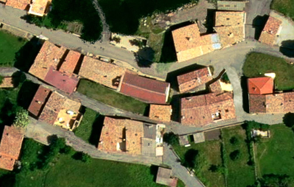
| After.png | ||
| Description: |
|
|
| Filesize: | 1.21 MB | |
| Viewed: | 14562 Time(s) | |
 |
||
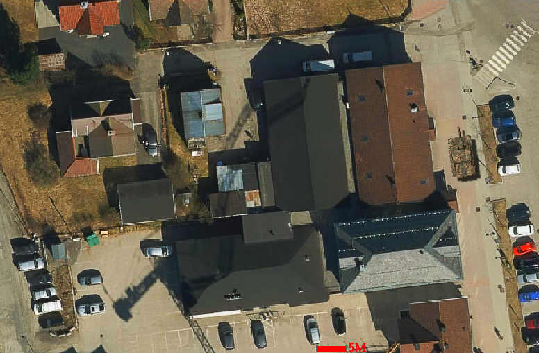
| Test town 8pix pr meter.png | ||
| Description: |
|
|
| Filesize: | 680.81 KB | |
| Viewed: | 14523 Time(s) | |
 |
||
| Quote: |
| Did you use digital elevation data or code the elevation manually? |
| Quote: |
| I am suprised to say that I found it to be quite pleasing graphics wise and the all natural tree placement and buildings make it interesting to play. |
| Quote: |
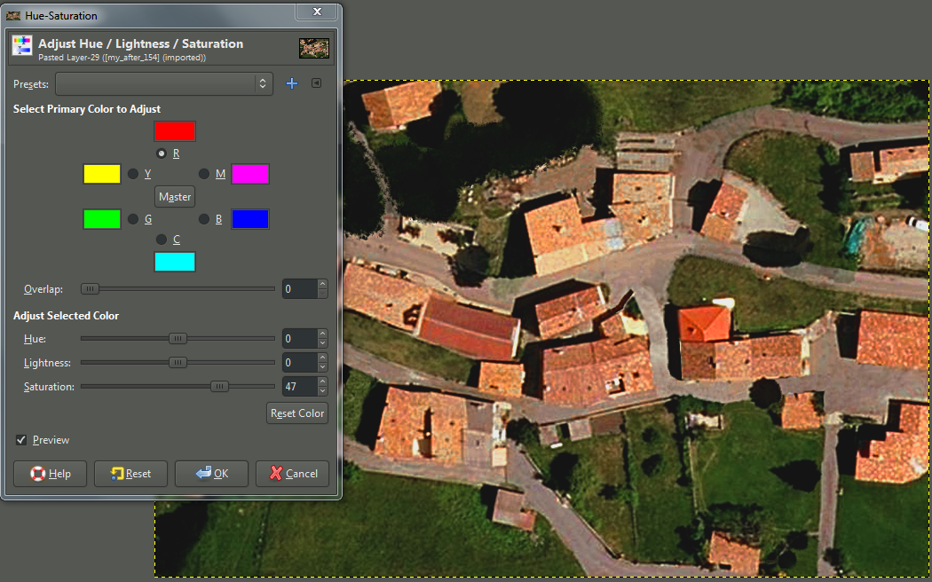
| I think the colors directly from the satelite imagery is too de-saturated - too washed out - especially on buildings |
| Quote: |
| Google Roofs....And Google Maps Suck! |
| Quote: |
| - Noticed the coding or graphics doesnt tell you how many floors are in the buildings. - Would be nice if coding and and numbers could be implemented. |
| Quote: |
| I think the colors directly from the satelite imagery is too de-saturated - too washed out - especially on buildings |
| after_186.png | ||
| Description: |
|
|
| Filesize: | 1.21 MB | |
| Viewed: | 14361 Time(s) | |
 |
||
| my_after.png | ||
| Description: |
|
|
| Filesize: | 700.6 KB | |
| Viewed: | 14361 Time(s) | |
 |
||
| before_210.png | ||
| Description: |
|
|
| Filesize: | 1.29 MB | |
| Viewed: | 14361 Time(s) | |
 |
||
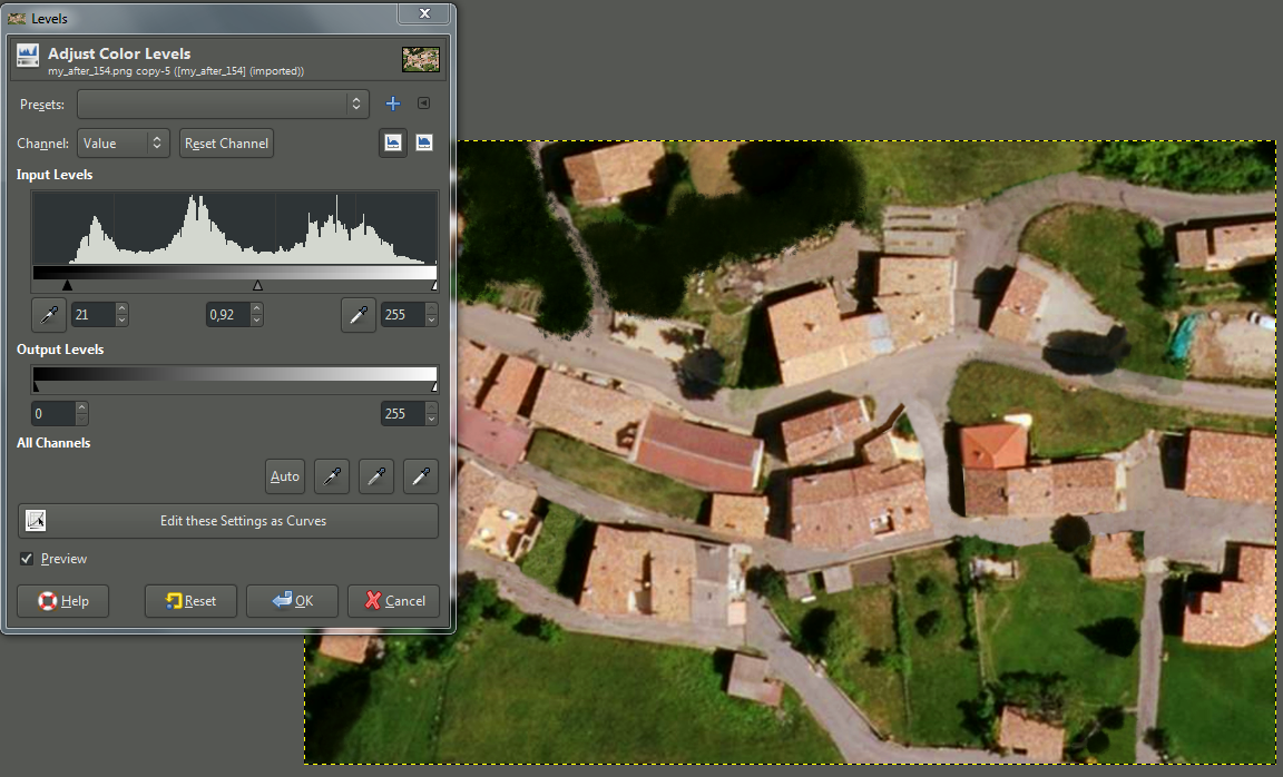
| Color Levels 1.PNG | ||
| Description: |
|
|
| Filesize: | 1.17 MB | |
| Viewed: | 14336 Time(s) | |
 |
||
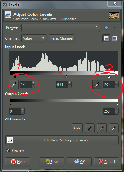
| Color Levels 2 pick light and dark points edit.png | ||
| Description: |
|
|
| Filesize: | 62.87 KB | |
| Viewed: | 14336 Time(s) | |
 |
||
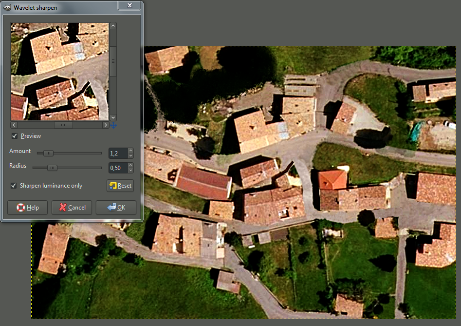
| Wavelet sharpen.PNG | ||
| Description: |
|
|
| Filesize: | 1.19 MB | |
| Viewed: | 14336 Time(s) | |
 |
||
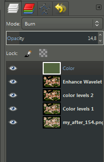
| Layer mode Burn.PNG | ||
| Description: |
|
|
| Filesize: | 20.09 KB | |
| Viewed: | 14336 Time(s) | |
 |
||
| Hue lightness saturation.PNG | ||
| Description: |
|
|
| Filesize: | 992.01 KB | |
| Viewed: | 14329 Time(s) | |
 |
||

| Quote: |
| tanks need 3 elements of passable terrain between obstacles |
| Quote: |
| some of the bldg shadows on your map look to be at least 2 stories high |
| Quote: |
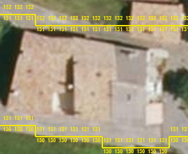
| areas like the top left are rough enough to be coded as high grass instead of grass field |
| Quote: |
| any foliage that casts even a tiny shadow should be coded as something other than grass (brush, bush etc) |
| Quote: |
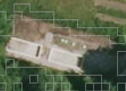
| I see a number of empty pools or water storage sumps |
| Quote: |
| Code the rows of harvested hay as fodder stacks. more terrain types is better = if it looks like a unique object on the map try to give it a unique element type |
| Quote: |
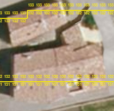
| You have mostly avoided putting bldgs on a slope, a very common mistake. What happens when you do is this... ...which can cause weird effects like units having fire fights through the roof. The steeper the slope a bldg is placed on the worse these effects |
| Quote: |
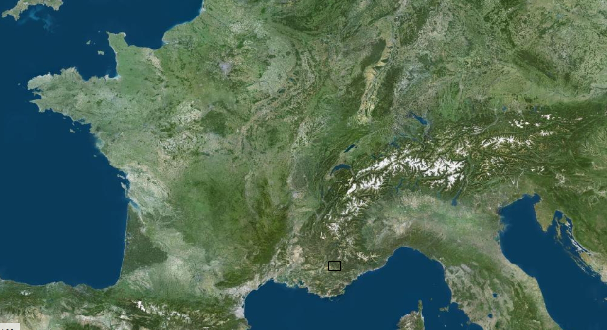
| Am curious where this map is in Europe? Looking forward to v0.2 |
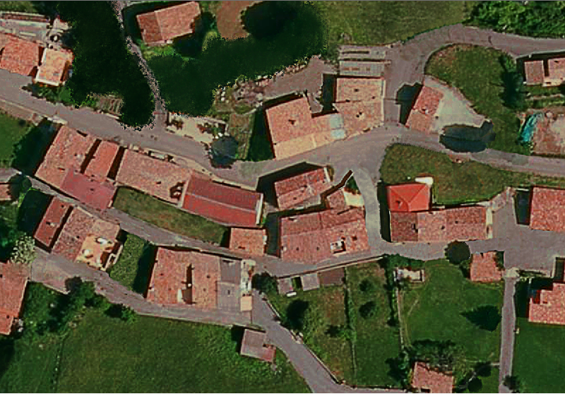
| bastide_mini.png | ||
| Description: |
|
|
| Filesize: | 520.51 KB | |
| Viewed: | 14239 Time(s) | |
 |
||
| inalpes.jpg | ||
| Description: |
|
|
| Filesize: | 602.94 KB | |
| Viewed: | 14239 Time(s) | |
 |
||
| separation.jpg | ||
| Description: |
|
|
| Filesize: | 50.53 KB | |
| Viewed: | 14239 Time(s) | |
 |
||
| prevent.jpg | ||
| Description: |
|
|
| Filesize: | 56.86 KB | |
| Viewed: | 14239 Time(s) | |
 |
||
| w.jpg | ||
| Description: |
|
|
| Filesize: | 44.48 KB | |
| Viewed: | 14239 Time(s) | |
 |
||
| my_after_2.png | ||
| Description: |
|
|
| Filesize: | 436.31 KB | |
| Viewed: | 14239 Time(s) | |
 |
||

| Quote: |
| Looking forward to V2 and your second map as well:) |
| Quote: |
| This image is a better illustration of the problems caused by elevation changes within a bldg. As the elev of the floor changes so does the elev of the roof 8 increments (= 4m) above the floor. This creates gaps in the roof allowing units in the bldg to see and be seen (shoot and be shot). This mistake is all too common on original as well as custom maps. |
| my_afte_3r.jpg | ||
| Description: |
|
|
| Filesize: | 679.68 KB | |
| Viewed: | 14172 Time(s) | |
 |
||
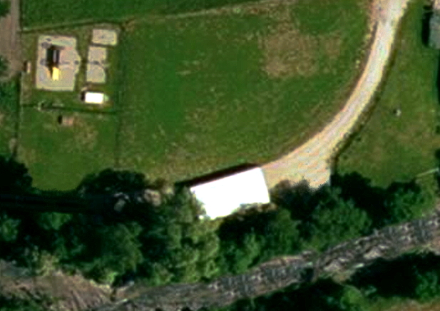
| white_zones.jpg | ||
| Description: |
|
|
| Filesize: | 244.46 KB | |
| Viewed: | 14132 Time(s) | |
 |
||
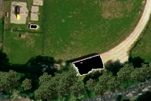
| black_zones.jpg | ||
| Description: |
|
|
| Filesize: | 189.72 KB | |
| Viewed: | 14132 Time(s) | |
 |
||
output generated using printer-friendly topic mod. All times are GMT