—
Some time back several of us started on a mod for the Great War battle of Cambrai (unfortunately the wheels fell off fairly early in the project) and I started experimenting with the idea of using gps software to as a way to use historic maps and/or aerial photos for Close Combat maps. As a bit of a backgrounder there were two articles written by Howard Anderson that might be of interest to some folks.
http://www.westernfrontassociation.com/thegreatwar/articles/trenchmaps/stand.htm
http://www.westernfrontassociation.com/thegreatwar/articles/trenchmaps/stand2.htm
A recent software development that is really exciting has been released this year. I really struggled with trying to make sense of the Bonn Projection used in the old trench maps but the developers figured out the math for it. Some good links on this site too.
http://www.greatwardigital.com/scope.shtml
I saw this one come up on the Advertisements at CCS last week.
By now you are probably wondering where I am going with this........so a few pictures to explain. Stay tuned........
| Map00 SatImage.png | ||
| Description: |
|
|
| Filesize: | 233.8 KB | |
| Viewed: | 3154 Time(s) | |
 |
||
| Map00 Modern.png | ||
| Description: |
|
|
| Filesize: | 367.32 KB | |
| Viewed: | 3154 Time(s) | |
 |
||
| Map00 Layout.png | ||
| Description: |
|
|
| Filesize: | 869.91 KB | |
| Viewed: | 3154 Time(s) | |
 |
||
—
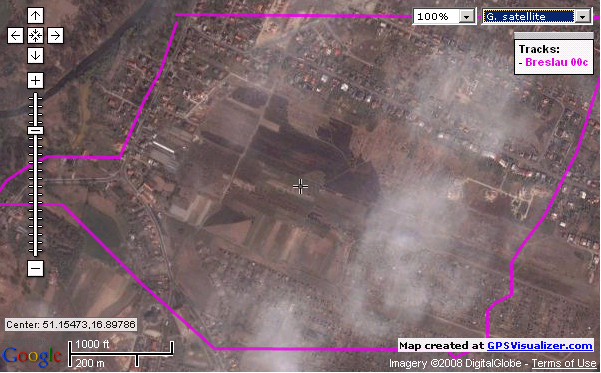
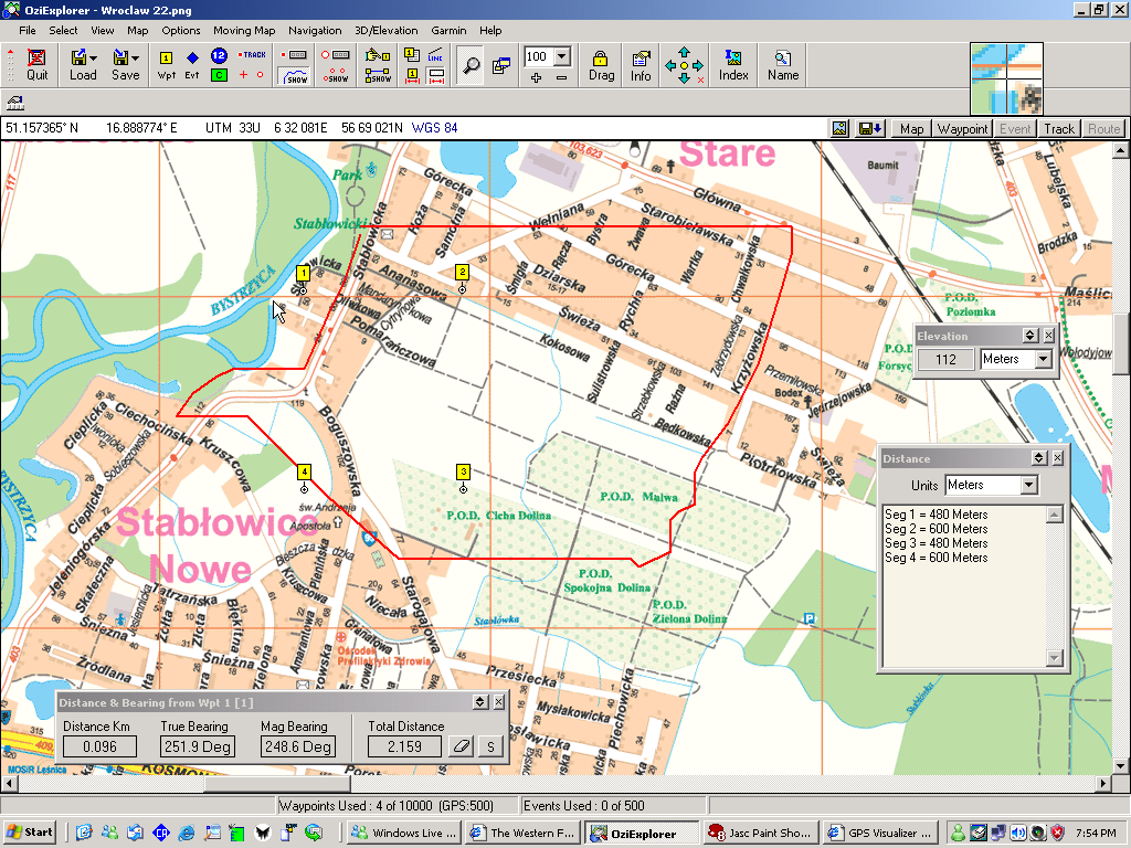
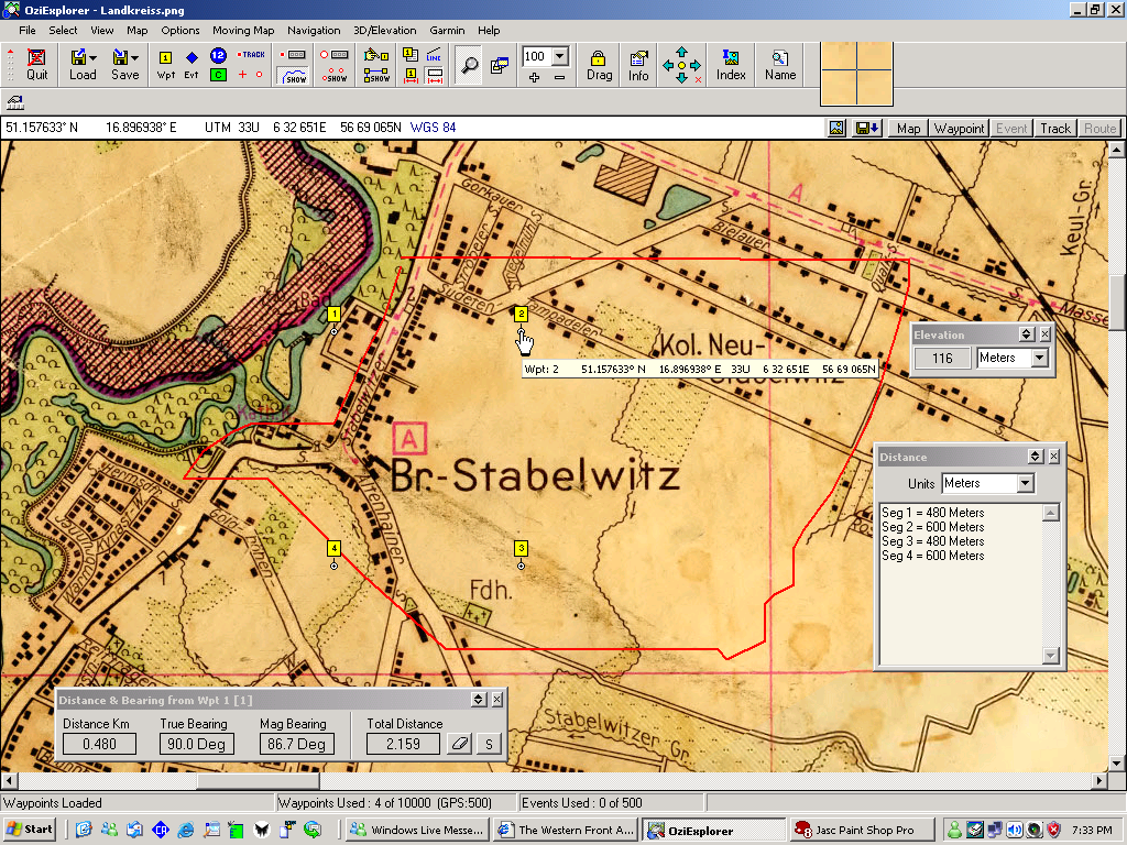
This is a track log of the 00 sector from my stratmap for Festung Breslau (now called Wroclaw). The old map is a 1:20,000 projection from the mid forties judging by the street names. I find it interesting that almost every city in the greater Reich had a street renamed after Horst Wessel and a sportsplatz renamed for the illustrious leader of the Luftwaffe.
OziExplorer has a neat feature that allows you to know the distance between waypoints so laying out different sized maps is quite easy. For this one 480 x 600 meters translates to 2400 x 3600 pixels in CC scale. The next step then is to make a blank map of that size and geo-reference the corners with the same co-ordinates as the waypoints. Then it is a matter of tracing the roads, buildings and other features on the historic map, and transfering them onto the blank map. The end result is a pretty nice template to start working on. If I allow a little extra on the track logs the template can be moved some in the event that the VLs need a bit of relocation. A 120 pixel grid should be helpful for checking that.
One point of interest is the location of the old hydro generation plant (near waypoint one). It was decommissioned in recent years and the old channel appears as the murky water on the satellite image.
Although much of Breslau was destroyed during the siege it is still useful to see what the surrounding landscape looks like today. GPS Visualizer is a free online utility that accepts waypoints and track logs in almost every format and is very useful for checking map calibration.
http://www.gpsvisualizer.com/
If folks are interested I will post some more screen shots as the project develops.
cheers
—
| yukongold wrote: |
| The next step then is to make a blank map of that size and geo-reference the corners with the same co-ordinates as the waypoints. Then it is a matter of tracing the roads, buildings and other features on the historic map, and transfering them onto the blank map. The end result is a pretty nice template to start working on. If I allow a little extra on the track logs the template can be moved some in the event that the VLs need a bit of relocation. A 120 pixel grid should be helpful for checking that. |
What would be wrong with simply importing the historical map into your graphics program (or SketchUp Sandbox
—
A legitimate question Talorgan.
It looks like *%#& at 1400% zoom, which is what it would take to bring it to CC scale. The main advantage is that the track logs are essentially scaleable vector graphics. The other thing is that I'm using a number of map types for reference; one at 1:100,000, 3 at 1:25,000 and the Kreismap at 1:20,000. With this method I can lift features off different maps and transfer them onto the templates.
cheers
—
I kinda knew that you'd be several steps ahead of the rest of us, but it's good to hear the details!
Cheers!
output generated using printer-friendly topic mod. All times are GMT