| Quote: |
| The natural barrier shows you where you can and cannot go. I do not see any natural barriers in this map for WaR. |
| schrecken wrote: |
|
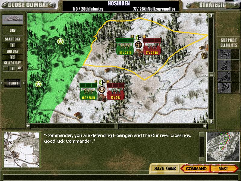
Who said all maps will represent towns or cities.
Plenty of Bulge fighting took part in rural areas, so there is a chance this may be represented on at least one of the 64 maps I can count on that pic.. (43 in cc4) |
| AT_Stalky wrote: |
|
2) I also wonder, the resolution, is that image abow at 800x600? For the “hole” to see the strat map seem v small. Is it so? So if I have lets say 1600x1200? resolution will I have a bigger “hole” to see the stratmap through, that will make it more easy.. |
| 1920 x 1200.JPG | ||
| Description: |
|
|
| Filesize: | 143.92 KB | |
| Viewed: | 13334 Time(s) | |
 |
||
| Quote: |
|
This is how it looks in screensize 1920 x 1200 on my 25 monitor hmm...
..but as mooxe sad, it is just a beta. |
| Quote: |
|
Dima those rivers may be frozen, shallow, roads or dried up river beds.
|
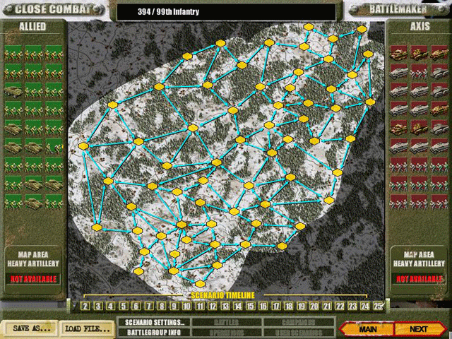
| AT_Stalky wrote: |
|
Hmm, the "real" ingame strat map may? look like this.
1) I think it’s ok that natural barriers shall block movement. But on the GC ingame strat map, I would prefer easy much informative arrows/signs that tell me what connections is allowed from each map. Planning a GC I want to avoid run into a dead end, or rather a cramped junction. 1B) I cant see them connections that easy in this image abow, or am I missing something? Maybe, we can have some more images please, so we see how this is made and how visible those connections are? 2) I also wonder, the resolution, is that image abow at 800x600? For the “hole” to see the strat map seem v small. Is it so? So if I have lets say 1600x1200? resolution will I have a bigger “hole” to see the stratmap through, that will make it more easy.. edit: spell |
output generated using printer-friendly topic mod. All times are GMT