| vonB wrote (View Post): |
|
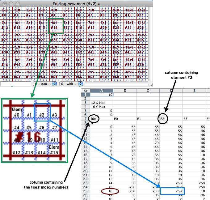
For example, let's say I want to add a Minefield at a specific location (x,y) on the Map, and want to add the entry manually, how would I go about it?
Is there any documentation that explains the format of the TXT file in detail? |
| TheCCMapDataTileConcept-small.jpg | ||
| Description: |
|
|
| Filesize: | 119.73 KB | |
| Viewed: | 7720 Time(s) | |
 |
||
| papa_whisky wrote (View Post): |
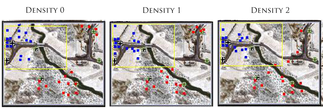
| So a change in the state of an element in the saved game file will be given by the tile and element within it? |
| Density Test.jpg | ||
| Description: |
|
|
| Filesize: | 311.61 KB | |
| Viewed: | 7651 Time(s) | |
 |
||
output generated using printer-friendly topic mod. All times are GMT