—
First impressions.
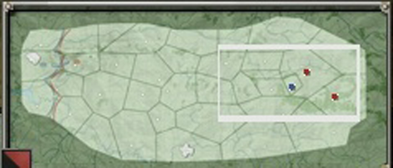
Nice wide map.
A few key maps look very pivotal, can stop the advance or by taking the map, crush the defence.
Less maps, great! 35 is not a bad number, this should amount to more finished grand campaigns.
The borders of some maps are strange. Why is the map near the upper left a triangle?
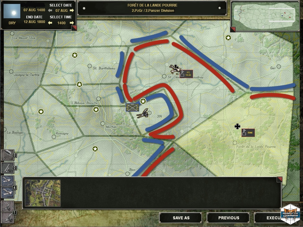
I hope all maps that share borders also share a connection. I can see roads on the images, Wacht Am Rhein has these as well but no actual connections. Look at the small square map with the artillery icon on it, directly below it there is a shared border with two maps (where the red/blue highliting is) with a forest covering the border. Will there be a map connection there?
I think this is an improvement over previous re-release strategic maps.
Last edited by mooxe on Sun Sep 23, 2012 6:44 pm; edited 2 times in total
| panthers_in_the_fog_stratmap2.jpg | ||
| Description: |
|
|
| Filesize: | 141.67 KB | |
| Viewed: | 8740 Time(s) | |
 |
||
| panthers_in_the_fog_stratmap1.jpg | ||
| Description: |
|
|
| Filesize: | 399.87 KB | |
| Viewed: | 8740 Time(s) | |
 |
||
—
If you look closer it seems the BG's used in the pic are from LSA as the 101st, KG Rink and the 59 Inf Div aren't mentioned in the wiki page to have participated in the battle but are mentioned as being in holland in late 1944. It also has topographic information for I guess, having a quick look as to where the high ground is because one of the features is to being able to see enemy BG from high ground.
There are also strange irregular white figures at the bottom and on the middle map from the left border of the strategic map, clouds? fog?.
I can accept adjacent maps not having a connection, but they must be done in a logical way like separated by a river (Orne in GJS which made pegasus bridge very important) or dense forests,the connections must therefore be very explicit to avoid confusion as in WAR.
—
35 maps out of the box but can that be modded upwards?
—
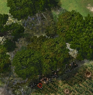
Nice big, new trees instead of the old lollipops. It will be interesting to see how these get coded for terrain. SOP has been to account for the undergrowth (leaves/brush) as a solid column, providing LOS hinderance, concealment & cover, the rationale being that since CC maps show fewer trees than actually would exist, the trees that do get shown should have more 'impact'. The new treetops, however, spread out from their trunks much further and their terrain effect should start at ~3-4 meters to reflect the open space underneath. To allow LOS/LOF under these treetops will require a new terrain element similar to LSA's 'Under Bridge'.
Im also partial to the 'bloodless' KIA/Incaps although this is probably just an unintended feature of a stripped down PitF dev version.
Cant say I care much for the new red/blue 'front line' graphics. Not much room available for the possible graphics that could be displayed if you had a BG isolated on a small map like L'Abbaye Blanche.
The strat map contour lines should be more visible. Why contours were never used on the Overview maps is a complete mystery.
| PitF_trees.jpg | ||
| Description: |
|
|
| Filesize: | 78.7 KB | |
| Viewed: | 8565 Time(s) | |
 |
||
—
Insider info...I love it. Some VIP's online here. Yes it does look very similar to LSA. Although Q4 is a long ways away...lots of time left until the product is released.
—
And again, icon placements over the map names... :roll:
(requested this to be adjusted for LSA already)
—
Is the left border of the stratmap representing the shores of Avranches in order to let the Allied line of supplies to be possibly (even if ahistorically) cut off from Normandy positions?
output generated using printer-friendly topic mod. All times are GMT